Thursday, December 25, 2008

Merry Christmas everyone!

Wishing you all a very merry Christmas, hopefully as merry as ours
was...

The evening started with champagne and strawberry wine apéritif, then went on to a gargantuan dinner (carpaccio, snails, salmon tagliatelle, poire wiliam sorbet, capriolo with potato gratin, nougat mousse) and an evening of dancing.

Maybe the dinner, maybe the alcohol, maybe the dancing, I'm not sure what it was, but I ended up sleeping until well into the afternoon the next day, completely missing another gargantuan meal for Christmas lunch !!

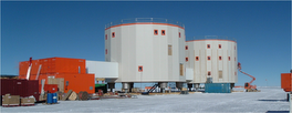
This is going to be a short post, as tomorrow is our first field visit to the CASE stations (no such thing as Boxing Day out here...). We leave in the morning, and shall stay out the whole day. We have finished preparations, and are all getting an early night to be fit and ready for tomorrow.

Merry Christmas everyone!

Tuesday, December 23, 2008

Gearing up for Christmas...

Two days to Christmas, and the nose is still firmly to the grindstone. It looks like we might finally be centering in on the problem with the datalogger, and that it might be caused by a faulty component. A replacement is being sent to us via another person from my lab, who is leaving France to come here on December 30th. We are keeping our fingers crossed that they will both arrive ok.

Christmas seems to be a big affair out here. We have two trees covered with tinsel in the dining room (trees?? on the Antarctic plateau?), and plenty of foil-based decorations strewn on the walls and dropping from the ceiling, accumulating static electricity and zapping every other person than walks by. Someone has decided that Christmas music should be played during meals... personally, I think that is going a bit too far...

We are going to have a special Christmas dinner tomorrow night. We are supposed to stop work at 4pm, in order to get ourselves washed and prettified for the evening (the cooks have requested that we be smartly dressed, which given the effort they are putting into making the dinner is only fair). We start with an apéritif at 7:30 (we have been strongly encouraged to attend - maybe that means they will break out the last of the Champagne ??), then go on to dinner and a Christmas Eve party.

I'm charging my camera batteries this evening so as to be able to send you pictures of the event. For now you will have to make do with this picture of me walking back from the seismic shelter (the yellow blob in the background). The sky is blue and featureless, the snow is white, featureless and flat, and there is a lot of both. That's Dome C for you: nothing as far as the eye can see... spectacular!

Monday, December 22, 2008

A data logger with a problem

You may recall from my descriptions of the seismic observatory at Concordia in last year's blog posts, that we have two seismometers down there, each connected to a different data logger. Both have worked reasonably well over the course of 2008, considering the conditions they run in (those of you who have kept up to date with http://case.u-strasbg.fr know this already).

However, on December 10th, for no apparent reason, one of the data loggers (a Q4120) stopped working. We have been trying to deal with the problem remotely (i.e. sitting warmly in our lab at the base, and working over a wireless connection to the seismology shelter that is 1km away) since we got here on the 18th, but have had little success. Last Saturday, the machine decided it no longer wanted to talk to us over the network, so we strolled over to the shelter (err... trudged would be more appropriate in my case, I'm not yet fully acclimatized to the altitude) to try to fix the problem. To no avail.

It was obvious that we would not be able to fix the recording system at the shelter, and that it needed to be brought back to the lab. However, carrying it over that distance by hand was not a viable proposition, so we simply prepared it for transport and left it there, knowing we would have to come back with some transport system to pick it up.

The route to the seismic shelter goes past several other scientific shelters, including one in which the air is continually filtered and its composition measured. Because of this particular experiment, we are not permitted to take a vehicle along the route, and so (in all but exceptional circumstances) have to carry equipment to and from our shelter on foot, either in backpacks or on sledges.

We went back to the shelter this morning, in order to pick up the faulty data logger. The photo above was taken this morning, and shows the Q4120 being pulled along by a volunteer Sherpa, a glaciologist by the name of Bruno who is much better acclimatized than either my colleague Maxime or myself. The data logger is now sitting on a table our the lab at the base, with all its innards visible, and cables strung across the room to various other bits of equipment. We have made some small progress to getting it working again, thanks mainly to valuable suggestions from our colleagues in Europe and the the manufacturer himself, but we're not finished yet!


PS: I must still have been over-tired when writing yesterday's post. Of course the picture in that post is not of Mount Ross (which is on Kerguelen Island in the sub-Antarctic) but of Mount Erebus, on Ross Island in Antarctica.

Sunday, December 21, 2008

Sunday insomnia

Days of the week swiftly loose their meaning when you are cut off from the rest of the world. Just as we try to keep a normal 24 hour daily schedule, we also try to keep a normal weekly schedule. Sundays are set up to be a day of rest: breakfast is from 8 to 10 am instead of from 7 to 8 am on weekdays, the evening meal is a buffet of the previous week's left-overs to give the cooks a half-day off duty.

It is very hard to stop working during a summer campaign, as there is a great deal to do in the limited time we have up here. It is common for most people to work 7 days a week, with the only change being a slightly later start on Sundays. Although this rhythm cannot be sustained eternally, most of us try to keep it up for the 4 to 6 weeks of our campaigns.

However, if you add to this situation fatigue caused by insufficient adaptation to altitude, by sickness, or simply by lack of sleep, then you can end up in trouble, as I found out to my expense this morning.

After lying awake from 2 to 5 AM unable to get back to sleep, I thought I would get up and start my day. I've not had a decent night's sleep since arriving here. This morning, instead of doing something harmless - like doing some TaiChi or Yoga, or simply browsing the comic book collection in the common room - I decided that I should get started on some of the work that had been buzzing around my brain all those hours.

On a Sunday morning... At 5 AM... After fewer than 3 hours sleep...

Well, the obvious happened, and I messed up. I was overly confident in my abilities, did not take enough care to check all the premises of the line of thought I was pursuing, and eventually made a big mistake. It was not an extremely serious mistake, and it was corrected easily enough later in the day, but it did lead to the loss of about 10 hours of secondary data from the only working seismometer at the CCD observatory. Not the end of the world, granted, but I should have known better!

Lesson to be learned: lack of oxygen, lack of sleep and excess confidence are a disastrous combination! I shall have to work hard on the third element in the next few days, at least until I develop a regular and restorative sleeping pattern.

PS: The image is of Mount Ross, taken from the airport at McMurdo.

Friday, December 19, 2008

First full day at work

We all know it takes a while to get used to the conditions up here at Dome C, so we gave ourselves a good... err... 36 hours rest and planning time before getting down to the nitty-gritty stuff.

Yesterday we spent the day reviewing the status of both the CCD observatory station and the autonomous CASE field stations, and digging up lots of information that somehow never made it to Strasbourg. We had a number of surprises, some good, some less good, but by the end of the day we had an adequate mental picture of the current status and the work ahead.

Today we have worked on improving the radio connection to the CASE stations, and updating the firmware on the Q330 acquisition system at the observatory station. I shall spare you the technical details (they are being written up for our collaborators back home) and just say we should see the results of these changes in the next day or so.

The snow and ice around Concordia are flat for as far as the eye can see, which makes for poor photographic opportunities. In order to spice things up a bit, I've posted above a picture I took on the flight from Christchurch to McMurdo, in which you can see a stunning mountain range framed by the C-130's window.

What surprised me was the sharpness of the features, with the mountain crests standing out like knife edges. In some places we could see huge glaciers snaking their way down from the crests, with sets of curved crevasses showing the direction of flow. The excellent visibility made for a superb show, which went a long way to easing the boredom of the noisy 7 1/2 hour flight!!

Thursday, December 18, 2008

Jet lag and then some !

Greetings from Concordia!!

We arrived safe and sound last night, in the aircraft shown above (a very comfortable DC3). The journey to get here has been long and tiring (3.5 days of flying), with a lot of waiting around between planes and little sleep, but it has been otherwise uneventful. There are a great many people here this year who were also here last year, which made for a good reunion.

We are now happily installed at Dome C. It will take a few days to get over the jet lag (we've changed time-zones so often in the past four days we're totally confused) and to get used to the altitude (sleeping is difficult, any physical activity makes my head spin right now) and the 24 hour sunlight.

Dome C hasn't changed much from last year: it's still as flat and white as ever! Little has changed at Concordia base itself either, except that women now have a proper toilet they can use, and no longer have to rely on buckets: hooray for civilization !!

I should go start my day now. A quiet one as far as work goes, as it is important not do overdo things for the first few days. My task for the day: figure out where everything has moved to during the winter, and what the status of all our instruments is.

Monday, December 15, 2008

Stopover in Hong Kong

Having been traveling now for a little over 24 hours, we have now completed the second of the six legs of the trip that will take us to Concordia. There are 7 of us on this trip, though only 2 from Strasbourg. We met up at the airport in Paris, and shall travel as a group all the way to Concordia.

The voyage has been good so far, with a comfortable aircraft and good weather for our morning walkabout in Hong Kong today. This year's impressions of Hong Kong reflect those I had a year ago: a very disturbing place by virtue of the juxtaposition of poverty and squalor with luxury and modernity.

Three of us have come back to the airport early, leaving the others to explore more widely. In the lounge we have been given access to thanks to IPEV, we are enjoying comfortable armchairs, internet, food, and even the access to showers. We are stocking up on comfort for the next two legs of the trip: another long haul flight to Auckland, then on to Christchurch.

Next update from New Zealand!

Saturday, December 13, 2008

30kg for six weeks

Less than one day left, and I have just finished packing my bags for 6 weeks in Antarctica. All the cold weather gear is supplied by IPEV (the French polar institute) and should be waiting for me in Christchurch NZ. I go through Paris, Hong Kong and Auckland to Christchurch, then fly to McMurdo, and then on to Concordia, so there will be no seasick posts from the Astrolabe this year - yay! The rest of the stuff I am taking is shown below:


And here is what it all packs down to:


Not bad, eh? It all weighs in at under 30kg (of which 9kg are scientific material we shall need in the first two weeks at Concordia): so whoever said girls cannot travel light should think again.

To be perfectly honest, I'm not quite finished packing: I am still missing the warm socks I got during last year's trip and my pocket knife, both of which are probably in my office. At least I hope they are, for I don't much fancy leaving without them!

PS: Found the socks. Still no knife...

PPS: Phew! Finally found the knife! It was at home after all...

Friday, December 12, 2008

Sunday Seismometer digest

Just a quick post to announce the appearance of the Sunday seismometer digest, a pdf version of the Sunday Seismometer series.

Heads up

Hello everyone!

Yes, I'm still here... although you would be pardoned for thinking
I'd dropped off the planet somewhere... I can't believe it has been
three months since I last posted anything!

Just a quick heads up to let you know I'm off to Antarctica again,
and leaving this Sunday. This year's trip won't be quite the
adventure it was last year, as I know what I'm getting into this time
round! I shall keep you posted...

In the meantime, in keeping with the current Wordle craze, here is
one of the projects that has kept me from blogging over the past
three months (my latest contribution to the technical literature in
seismology).


Any guesses on the topic of this paper??

Sunday, September 7, 2008

Sunday Seismometer #12

Rocard (1958)


From last week's prototype, let's move on to a more useful set of instruments, designed specifically to detect nuclear explosions in the context of Comprehensive Test Ban Treaty monitoring.


They are named after Professor Yves Rocard, the physicist who started to develop detection seismology in France in the 1960s, and who founded the division of the French Atomic Energy Commission (CEA) that is in charge of geophysical studies and activities associated with monitoring and the environment (LDG).


The Rocard is a classical electromagnetic seismometer, with a 1s natural period and electronic amplification. Rocard instruments were in operation at the Welschbruch station not far from Strasbourg.

Sunday, August 31, 2008

Sunday Seismometer #11

Peterschmitt (1950)


Continuing our mini-series on electromagnetic seismometers (see the Galitzine and Press-Ewing posts), here is a seismometer you are unlikely to see anywhere else. The Peterschmitt was designed and built in Strasbourg in 1950, where it was in use until 1975.


This admittedly ugly looking beast is a prototype classical electromagnetic seismometer (you can see its coils on the near side, very similar to those on the Galitzine instrument) combined with a galvanometer. It has a natural period of 1s, and its amplification is provided by a resistance bridge. The most interesting feature of this instrument is its original inbuilt calibration system.

The design of this instrument is attributed to Elie Peterschmitt, who was recruited by Strasbourg in 1937, took charge of the Strasbourg historical seismological station as well as the stations of Besançon and Bagnères de Bigorre, and later helped develop the European-Mediterranean Seismological Center (EMSC).

Thursday, August 28, 2008

On batteries and aeroplanes

Earlier this week I wrote about space-crafts with thermostatic skins, implying this kind of technology could prove to be useful for temperature control in low-power autonomous seismic stations in the Antarctic. Here is another technological achievement that may be of some use.

The BBC reported over the weekend that a UK-built solar-powered and unmanned plane, the Zephyr-6, had stayed aloft for more than three days, running though the night on batteries it had recharged during the day.

The Zephyr weighs 30kg and flies at an altitude of over 60,000 feet. Its power derives from solar power generated by paper-thin amorphous silicon solar arrays glued over the aircraft's wings. This power is stored in a new type of lithium-sulphur battery.

A lot of effort has gone into power storage and light-weighting the systems. Lithium sulphur is more than double the energy density of the best alternative technology which is lithium polymer batteries. Mr Kelleher, Qinetiq (UK defense and research firm)


These batteries are made by the Sion Corporation:

The custom built Li-S battery pack was designed and assembled by SION Power and consisted of 576 cells built into a battery configuration of 12 cells in series and 48 in parallel. The battery utilized SION’s unique, high specific energy Li-S cells (350 Wh/kg). At ~10 kg, the Li-S battery pack was carefully engineered to minimize total pack weight.
In addition to providing flight power, the battery pack supplied power to a special
internal pack heating system to maintain the batteries at 0oC throughout the cold nights. Sion press release.


The Sion battery data-sheet is available here: sion_product_spec.pdf.

The usefulness of this kind of battery for our stations in Antarctica would depend on its adaptability to long-duration low-power applications, and on its performance at low temperatures. Yet another thing to look into this fall!

Tuesday, August 26, 2008

Funky thermostat film for spacecrafts

You may remember that keeping our antarctic instrumentation at a constant and not-too low operating temperatures is a major challenge. Some time ago I posted about the heating / insulation strategy we implemented in last year's prototype stations. I'm planning to write a short piece on how that strategy worked out in the next couple of weeks.

The subject of today's post is an innovation in thermostat technology that has just been presented at the 236th American Chemical Society' National Meeting in Philadelphia, and that was brought to my attention by the BBC News website.

Spacecraft have a serious problem with temperature regulation, as they operate in blazing sunlight, in the cold shadow of the Earth, or in even more extreme conditions closer or further away from the Sun. As operating conditions vary, so does the amount of heat generated by the onboard electronics.

For large spacecraft, [temperature control] is done with mechanical louvers—basically glorified window blinds—that open and close to allow in or reflect heat. But as satellites get smaller, these systems get too heavy and bulky. - Prasanna Chandrasekhar of Ashwin-Ushas, an American tehnology firm


Chadrasekhar and his team have developed a "skin" that can be placed on a spacecraft to actively control the amount of heat that it radiate by controlling its emissivity.

Polymers in the skin change their emissivity when electricity is applied to them, retaining heat in cold conditions and radiating it away in hot ones. That leads to an active temperature control that can be maintained with very little power.

The skin is just a few tenths of a millimetre thick, has been tested to withstand the rigours of the vacuum and temperature extremes of space, and can be bent and cut to fit craft of any shape without losing its properties.

Would such material be useful in Antarctic conditions, which are much less extreme than those experienced in outer space ? The answer will depend on the amount of energy required to power the emissivity-regulating skin.

Energy is a serious problem in Antarctica given the duration of the winter night. Should the new skin system be as low power and low-cost as announced at the conference, then its use in Antarctica may well be possible. We shall be keeping a lookout for updates on this product!

Saturday, August 23, 2008

Sunday Seismometer #10

Press-Ewing (1953)


Some 40 years after the Galitzine electromagnetic innovation, the same principles of operation are put to work in the Ewing-Press seismograph, built at the Lamont Geological Observatory of Columbia (now the Lamont-Doherty Earth Observatory) by Maurice Ewing and Frank Press.

In the photo below you can see the vertical Press-Ewing instrument on display at the Strasbourg Seismological Museum. It was in use in Strasbourg from 1963 to 1975.


It is an electromagnetic seismograph, coupled with a galvanometer, and has a natural period that can be selected and fixed up to 30s. Recording was optical, on photographic paper. The glass ball you can see on the near side of the instrument reduces the effect of variations in atmospheric pressure on the seismograph recordings, using the Archimedes principle.

This seismograph and its horizontal counterparts are very well adapted for the recording of surface waves. In 1957-58, Press-Ewing instruments were deployed in 125 locations around the globe to establish the World-Wide Standardized Seismograph Network, the first global earthquake monitoring system.

Sunday, August 17, 2008

Sunday seismometer #9

Galitzine (1910)

All the seismographs we have discussed up to now (Reuber-Paschwitz, Reuber-Ehlert, Wiechert horizontal and vertical, Mainka, Vicentini, 19-Ton, Mintrop) have been mechanical, with either mechanical or optical recording. Today's instruments, built by Galitzine in St Petersburg (Russia) in 1910, are the first examples of electromagnetic seismometers.


In the above photograph of the vertical Galitzine (mass 10 kg, period 24 s) you can see the new element of this seismometer: the coil placed at the end of the pendulum's rod. This coil oscillates in a magnetic field, and creates an electric induction current which can be measured using a galvanometer.

A copper plate, fixed on the same rod as the coil, oscillates in the field of a second magnet and provides damping via a Foucault current.


The horizontal instrument (above, mass 7 kg, period 12 s) works using the same principle. The object placed in front of the seismometer is a galvanometer that is equipped with a mobile frame and a mirror for optical recording.


The Galitzine instruments amplify Earth motion in two successive stages: an electromagnetic amplification (the galvanometer mirror rotates more than the pendulum oscillates) followed by the optical amplification caused by the distance between the galvanometer mirror and the recording medium.

Sunday, August 10, 2008

Sunday seismometer #8

Mintrop (built sometime after 1910)

From the very large (last week's 19-ton seismograph) to the relatively small : the Mintrop portable horizontal seismograph.


The Mintrop is an odd instrument, that measures horizontal motion using a damped inverted pendulum with a horizontal rotation axis. Its relatively small mass is coupled with a vertically oscillating mirror and an optical recording system.


Given the delicate nature of the recording system, the Mintrop must have been rather difficult to install. It is considered to be one of the first portable field instruments, and was used for early prospection studies by German oil companies.

Wednesday, August 6, 2008

Quake Catcher Network

Thanks to Julian over at Harmonic Tremors whose post about last Tuesday's M5.4 earthquake brought the Quake-Catcher Network to my attention again (I originally read about it on Geology News and Highly Allochthonous earlier this year, but did not have time to blog about it).

The Quake-Catcher Network is a collaborative initiative run jointly by Stanford and UC Riverside that aims to use acceleration detectors present in most modern laptops to form a low-cost strong motion seismic network.

Laptop users can download a client program that sits and monitors the motion of their laptops, sending information to the Network when any strong signals are detected. If strong signals are detected by many nearby laptops at the same time, the Network knows an earthquake is happening.

Laptops continuously move with the people who use them. So how does the Quake Catcher Network know where the laptop is? Users can give precise locations (using a GoogleMaps widget) of where they use their laptops most often. To choose between these locations, and also to deal approximately with undefined locations, the Network uses the laptop's current IP address. Nifty!!

As correct time is essential for earthquake location (just ask any observational seismologist or seismic network manager), the Network also checks the laptop's clock to make sure it is on time.

I have just signed up as a Quake-Catcher laptop client. The sign up procedure is completely painless (at least it was on my mac). Quake-Catcher uses a system called BOINC to interact with your computer. This is the same system used by other distributed computing projects you may have heard about, such as SETI@home or LHC@home.

Quake-Catcher aims to become a global strong-motion network, but it can only do so with your help. The more laptops connect to the system, the better. The accuracy of Quake-Catcher detections depends on the number of users located in any given region, so if you want your contribution to Quake-Catcher to be really useful, you should urge your friends, families and colleagues to sign up.

Monday, August 4, 2008

Another Antarctic Earthquake

In November of last year I wrote about an unusually large earthquake (M 5.8) that had occurred close to Casey Station in Antarctica. Earthquakes of this magnitude are rare in East Antarctica, except, it seems, in the Casey region...

Indeed, on July 23rd of this year, another large earthquake (M 5.3) occurred in the same region. The following image is from the USGS and shows the position of this event as an orange star.


This event was recorded on seismometers all over Antarctica. As examples, I have plotted the recordings of vertical ground velocity for this earthquake at stations CASY (Casey), MAW (Mawson) and PSP02 (a POLENET temporary station near South Pole).


The numbers under the station names on the above plot are distances in km from the earthquake. As you can see, the earthquake was well recorded even at distances over 2000 km.

We often say that the Antarctic plateau is virtually a-seismic, meaning there are few if any earthquakes. As you can see for this Casey event, it would be hard to miss an earthquake larger than M5 virtually anywhere on the continent. Smaller events may still be missed, however, and we do not have enough seismic stations in Antarctica (yet) to be sure that they do not occur.

Sunday, August 3, 2008

Sunday seismometer #7

Great Pendulum or "19-Tons"

In the last Sunday seismometer post on the Vicentini seismograph, we mentioned that in order for a seismograph to overcome the friction caused by a purely mechanical recording system, it needs a large mass.

The Vicentini instruments actually have the smallest masses (100 kg for the horizontal and 50 kg for the vertical) of the mechanically recorded seismographs we have described so far. The Mainka instrument has a 450 kg mass, the Wiechert horizontal instrument has a 1-ton (1000 kg) mass, and the Wiechert vertical instrument has a mass of 1.2 tons.

The largest mass of all the seismometers in the Strasbourg museum is that of the Great Pendulum: an impressive 19 tons (that is 19 000 kg)!


Its construction was started before the First World War (1910), when the Strasbourg Observatory was part of Germany. The idea was to build an instrument that would be similar to one installed in Göttingen, a 17-Ton seismograph. After the war, Strasbourg became French, and it was the French director of the Observatory, Edmond Rothé, who completed the construction of the Great Pendulum in 1925.


The mass itself is essentially made up of scrap metal from the War, including 12 tons of axles from military trucks and 2 tons of weapon parts.

The 19-Ton has a natural period of 2 seconds, and records both the horizontal directions of motion, like the Wiechert horizontal instrument. Also like the Wiechert, its motion is damped by air pistons.


The smoked paper recording system was abandoned in 1970 in favor of galvanometric recording. In 1987 the recording system was changed once again to digital recording using displacement detectors.

The 19-Ton instrument is still in working order today, and is a great favorite with visitors to the Strasbourg Seismology Museum.

Saturday, August 2, 2008

Summer vacation is over

With the end of July came the end of my much needed summer vacation. I took three weeks off last month in order to rest, recoup and recharge after this year's travels (7 weeks in Antarctica, and 4 weeks in the Sub-Antarctic islands).

I spent the time mostly sleeping, lazing on the beach, and swimming. This solar recharge should help me find the energy for the coming academic year: five research projects including the second year of CASE-IPY, teaching, and observatory work.

Here is a GoogleEarth image of my summer hiding spot:


While I was still on vacation, Kim posted about a great initiative to federate and publish geological maps from all over the world. The initiative is called OneGeology, and a new version of its portal will officially be launched next week. The current portal is already very easy to use. The image below is a larger scale GoogleEarth image of my summer hiding spot, in which the geologic units from the BRGM 1:1.5M geological map of Europe have been imported from OneGeology.

Sunday, July 13, 2008

Sunday seismometer #6

Vicentini (1895 and 1899)

Let's go back to the early days, and take a look at a contemporary of the Reuber-Paschwitz and Reuber-Ehlert seismographs. The Vicentini instruments are simple, un-damped pendulums, one to record the two horizontal components of motion, and another to record the vertical component.


The clock at the back of the image above is a precision chronometer that was used to produce the time base for the seismic recordings at the Strasbourg Seismic Observatory.

Built in 1895 and 1899 in Padova, Italy, the Vicentini seismographs had low sensitivity and were designed to record strong motion from local earthquakes. Their natural period is 1-2 seconds.


Where the Reuber instruments were lightweight (200 g masses) and used optical recording to reduce friction, the Vicentini instruments had heavy masses (100 kg for the horizontal and 50 kg for the vertical) and used a mechanical recording system. In order for a seismograph to overcome the friction caused by a purely mechanical recording system, it needs a large mass.

We no longer have the Vicentini recording systems. The horizontal system was installed under the pendulum mass and recorded the two components of motion and a time mark on a single sheet of smoked paper.

The two Vicentini seismographs operated in Strasbourg from 1895 to 1907.

Sunday, July 6, 2008

Sunday seismometer #5

Mainka (1910)

The Mainka seismograph is a large, single component horizontal pendulum (two instruments installed at right angles to each other are required to fully describe the horizontal ground motion).


Its 450kg mass is suspended in such a way that it oscillates around a near-vertical axis, with a natural period of 8-10 seconds. Damping is provided by a dash-pot system (a plate moving through a viscous fluid). Seismograms are recorded on smoked paper via a mechanical stylus, as was the case for the Wiechert seismographs.


Various models of the Mainka instrument with differing masses were built. The model shown in the photo above and visible in the Strasbourg Seismology Museum was manufactured by the Society for Optics and precision Mechanics of Paris (SOM). It is an improved model, of average sensitivity, robust and easy to tune, and was chosen in 1925 by the French Central Seismological Bureau (BCSF) for deployment at seismic stations throughout France and in the French colonies.

A Mainka seismograph operated at the Strasbourg Seismic Observatory from 1910 to 1960.

Sunday, June 29, 2008

Sunday seismometer #4

Wiechert vertical seismograph (1909)

The Wiechert vertical seismograph was built in Göttingen, Germany, in 1909, five years after the horizontal seismograph described in last week's post. The two instruments together formed a complete recording system, capable of determining the 3 components of ground motion.


The vertical seismograph has a mass of 1200 kg and a natural period of 5 seconds. Its design is more immediately recognizable by today's high-school students, as it is essentially a damped mass on a spring.


In order to reduce the temperature variations inside the instrument, which change the mechanical properties of the springs, the vertical seismometer is entirely enclosed by a metal casing, which makes it much less aesthetically pleasing than its horizontal companion. The small spring at the center of the instrument helps to correct for residual thermal variations.

The air-piston damping and the stylus and smoked-paper recording system are identical to those on the Wiechert horizontal seismograph.

The two instruments ran side by side in the Strasbourg Seismic Observatory until 1968. You can see working examples of both at the Wiechert Earthquake Station in Göttingen

Sunday, June 22, 2008

Sunday seismometer #3

Wiechert horizontal seismograph (1904)

The Wiechert horizontal seismograph (built in Göttingen, Germany, in 1904) has an unusual and striking design: it is essentially an inverse pendulum weighing 1 ton, in unstable equilibrium about a universal pivot at its base. Its natural period is 8 seconds.


The horizontal motion of the mass with respect to the casing is decomposed into its two perpendicular components, North-South and East-West, as we are used to seeing in modern-day instruments. The particularity of the Wiechert is its use of the 2D motion of a single mass to measure the two horizontal components of ground motion.

The motion of the mass is damped by air pistons (see schematic drawing). Damping is used in all modern seismometers to permit recording and interpretation of seismic energy after the first arrival. In undamped instruments, the later arrivals are drowned out by the oscillations caused by the first arrival.


The recording system is mechanical: two fine points scratch out the seismograms for each component on a roll of smoke blackened paper that rotates and translates in order for a full day of recording to be contained on a single sheet. This system is not dissimilar to the drum recordings used by the World-wide Standard Seismograph Network (WSSN) in the 1970s and 1980s.

The Wiechert seismograms contain minute marks made by lifting the two recording styluses in response to an electrical impulse that could be given by a contact switch on a precision pendulum, or by any other time-keeping device.

The Wiechert horizontal seismograph was kept working in Strasbourg Seismic Observatry from 1904 to 1968. It is now visible in the Seismology Museum, which is housed in the original observatory building.

Should you wish to see a working Wiechert seismograph, you should visit the Wiechert Earthquake Station in Göttingen.

Tuesday, June 17, 2008

Japan earthquake : an early warning failure?

The earthquake that occurred last Friday June 13th in Eastern Honshu, Japan - a M6.8 event according to the USGS, a M7.0 event according to JMA - occurred in a relatively lightly populated area, and caused few fatalities. Most of the damage seems to have been caused by landslides following the event (see Dave's landslide post).

In October 2007, Japan launched its Earthquake Early Warning system, meant to give the general population advance warning of the arrival of strong shaking. The system works by picking up the fast-arriving but non-destructive P-waves, producing an estimation of the earthquake location and magnitude, and sending out a warning to the region likely to be affected by significant shaking due to S- and surface waves.

How well did the system work for the June 13 earthquake? The following information comes from a NatureNews piece that appeared on June 16th.

The early warning system signalled a powerful quake 3.5 seconds after detecting the p-waves, but at places such as Oshu within 30 kilometres of the epicentre, the s-waves had already arrived. Residents of Kurihara, one of the cities hardest hit, received only 0.3 seconds of warning. Farther away, at a distance of 50 kilometres, the warnings were issued 5 seconds before the violent shaking; residents at 80 kilometres' distance were given 15 seconds. Those relying on television, radio and mobile-phone systems to relay the message would have had to have waited an extra second longer than those with an independent terminal that can receive the broadcast warnings directly.
The NatureNews article sees the Early Warning performance as a failure, saying the "controversial" system was "beaten" by the earthquake. I would not be so negative. It will always be difficult if not impossible to give adequate warning to the area immediately surrounding the epicenter for a shallow event, as the S-waves follow the P-waves to closely for even the fastest warning system to act (and I believe 3.5 seconds from first P-wave arrival to warning is not bad at all in terms of speed). This point is indeed conceded towards the end of the piece, but by then the damage is done.

I wonder if Nature has a beef with EEW (Earthquake Early Warning)? The three news articles published on the subject since the system was launched are all negative. From a purely scientific and technical point of view, I would say the system functioned properly, within its inherent limitations. These limitations are pointed out explicitly in the documentation given to the general public. I quoted the JMA explanation of these limitations in my first EEW post. Here is a brief summary:
  1. Timing: because of the time required to process the seismic data and generate a warning, areas close to the focus of an earthquake may not receive the warning before the strong shaking occurs.
  2. False alarms: these can occur when using data from only one seismograph.
  3. Magnitude: magnitude estimates are notoriously inaccurate, especially before all the waves generated from the earthquake have arrived.
  4. Seismic intensity: intensity estimates are limited in accuracy due both to the limitations in magnitude estimation and residual uncertainties in the local amplification due to land structure.
The acceptance / confidence problems currently plaguing the Japanese EEW system are in my opinion less due to failures of the system itself than to the inherent difficulties that occur any time one deals with warnings to the general public. Even though the limitations of an automated warning system may be explained clearly, the public is rarely generous of spirit when it comes to fearful occurrences such as earthquakes. Tsunami warning systems such as that run by the PTWC are confronted with similar difficulties, especially close to the focus of tsunamigenic earthquakes.

How should one deal with the general public? What is the actual tolerance of false alarms? What is the tolerance of underestimations of damage? I do not believe there is a cut-and dried answer to any of these questions. Moreover, the answer may change with time and will probably depend on the performance history of the system. We are still in the early days of Earthquake Early Warning. Maybe a few years from now we shall have a greater handle on how to deal with these issues...

Monday, June 16, 2008

CASE-IPY wake-up poll

As you can see from the state of health information for the CASE-IPY stations, the last station to fall asleep for the winter was CASE03 on April 18th. Our group at the lab has opened a pseudo-spread-bet on its wake-up date (pseudo, as in no money changes hands).

You too can participate in the betting using this online poll. The poll is open starting today and will run until July 30th (so you have six weeks to vote). I shall publish the poll results sometime in August, and as soon as the stations actually wake up, we shall have our winners.

Best of luck to all those who decide to play!


-----
Keep up to date with the latest developments at http://sismordia.blogspot.com

Sunday, June 15, 2008

Sunday seismometer #2

Reuber-Ehlert (1895)


In 1895 Reinhold Ehlert - continuing the work of Reuber-Paschwitz whose instrument provided the first recording of a distant earthquake (see Sunday siesmometer #1) - modified the original Reuber-Paschwitz design to come up with a new instrument.


The Reuber-Ehlert seismometer has not one but three undamped horizontal pendulums weighing 200g each, and has a natural period of 12 seconds.


A mirror is attached to each pendulum, and reflects a light beam back out through the windows at the front of the instrument. The reflected light can then be recorded on a roll of photographic paper. The amplification depends directly on the distance between the mirror and the recording apparatus.


The use of three horizontal pendulums to record two orthogonal directions of motion may seem curious to us today, as does the lack of damping in both this and the original Reuber-Paschwitz seismometer.

The Reuber-Ehlert seismometer was installed at the Astronomical Observatory in Strasbourg in 1895, then moved to the newly built Seismological Observatory in 1900, where it was kept running until 1906.

Wednesday, June 11, 2008

Earth Systems teaching

There is an interesting discussion on Kim Hannula's blog about the pros and cons of teaching Earth Systems science as opposed to more hard core Geology topics. Essentially the debate centers on the purpose of such courses for the students that take them. If these students end up in careers outside Geology, then having the kind of overview an Earth Systems course could offer would be more than enough. However, for students intending to continue to a Geology based job (in the oil industry for example) or to a master's or doctorate degree, such courses are wholly inadequate.

A similar debate is happening at the moment in the Geophysics circles at our lab. We are being asked to open up geophysics teaching to students from a variety of backgrounds, including a number who have little or no mathematical training. The question is how to follow these courses with a master's or PhD program that necessarily involves a great deal of mathematical analysis? As for the Earth Systems debate, the jury is still out on this one.

Tuesday, June 10, 2008

Earthquake cleared of causing Lusi mud volcano

It seems earthquakes have been cleared of causing the Lusi mud volcano in Indonesia:

The two-year old mud volcano called Lusi spews huge volumes of mud and has displaced more than 30,000 people and caused millions of dollars worth of damage. An international team of scientists has now concluded that it was caused by the drilling of a gas exploration well and not by an earthquake that happened two-days before the mud volcano erupted in East Java, Indonesia.
This result, contested at first and now confirmed, comes shortly after the publication in Nature Geoscience of a study suggesting earthquake triggering is a ubiquitous phenomenon, at least for earthquakes of magnitude 7. The main argument against earthquake triggering being the cause of the Lusi mud eruption is precisely a magnitude argument:
Prof Michael Manga, of University of California, Berkeley, said: “We have known for hundreds of years that earthquakes can trigger eruptions. In this case, the earthquake was simply too small and too far away.”

Read more about Lusi and its possible collapse here.

Tangjiashan quake lake

The M7.9 Sichuan earthquake of May 12th triggered a massive landslide that created a lake at Tangjiashan.

Landslide created dams are notoriously unstable, and the Chinese authorities have been trying to limit the possible damage from an uncontrolled breach of the Tangjiashan dam by cutting a sluice to evacuate the ever rising water.

It seems now that these efforts have been in vain... See Dave Petely's great series of posts on the subject.

[Thanks to Andrew and Chris for useful links into this subject.]

Monday, June 9, 2008

One year of blogging

Sismordia is one year old today. I shall mark the anniversary with a look back at my original hopes for the blog and how things have evolved over the past year.

In my very first post Starting out I wrote:

The Concordia Seismic Experiment - as we have lovingly named it - has gone from residing somewhere in my brain, to being present also in my gut. It's a daunting thing, especially for me, as this will be both my first complete seismic experiment, and my visit to Antarctica.

I've set up this blog partly in order to relieve some of the tension that's building up as we prepare to make this experiment a reality, but also to share the experience with as many people as possible. I hope to convince some of my colleagues working with me on the experiment to participate in writing the blog, and I hope to entice you all to read it and send in your comments.
So my stated goals were
  1. to share the experience of working in Antarctica;
  2. to elicit the participation of my colleagues;
  3. to entice you all to read my blog and send in comments.
Of these three goals, the first was for me the most important one, and I believe I have reached it. Blogging from the field in Antarctica was a great experience, and led to me compiling a Blog book about the campaign. I consider this document my greatest single blogging achievement.

In the second goal, I failed most miserably: Sismordia is still essentially a one-woman blog. My colleague JJL provided much needed copy-editing of the posts I emailed in from Concordia, but declined to write for Sismordia himself. As for those colleagues that have participated in the Antarctic seismology project (and continue to participate, for the project will live a few years yet), my greatest thanks go to JY.

My third goal was to be read. I was skeptical at first about the interest that a blog such as Sismordia could elicit in the blogging world. The subject matter is somewhat arcane, I tend not to deal in political controversy, and have not spent much effort in publicizing the blog.

Looking back over the statistics of the past year from Google Analytics, my 170 blog posts have received just over 5000 visits from about 3700 unique visitors who viewed a total of over 8600 pages. The graph below shows the number of visits per week over the past year. The peak in December-January corresponds to my Concordia field trip, which seems to have been the most successful time for Sismordia.


A few months after I started the blog, I linked my RSS feed through Feedburner. The number of subscriptions to my feed has risen gradually over the past year, and is now oscillating around 40.


So what can be said to sum all this up? Well for starters, I am still blogging, so the experience cannot have been too traumatic! As for the numbers, they are not Earth shattering, but are respectable all the same. I think I shall give my self a pat on the back as I settle into my second year of blogging.

Sunday, June 8, 2008

Sunday seismometer #1

When I first started this blog nearly a year ago, I ran a short miniseries on my favorite historical seismometers from those on display at the Strasbourg Seismology Museum. The original series petered out after on three posts on the Wiechert, Galitzin and Ewing-Press instruments.

I am starting up the series again as a weekly feature (the Sunday seismometer) that will run over the summer months. I hope you enjoy it!


Reuber-Paschwitz (1889)


The seismogram above represents the first recording of a distant earthquake. It was made on April 17th 1889, in Potsdam, Germany, of an earthquake that occurred in Japan.

The instrument that made this first historical recording was built by Ernst von Reuber-Pashwitz.

Three years later, an identical instrument installed in the Astronomical Observatory in Strasbourg recorded another distant earthquake that occurred in Baloutchistan (a region that is shared by modern day Iran, Afganistan and Pakistan).

These two recordings mark the beginning of modern seismology.

The Reuber-Paschwitz was small (about 40cm in diameter) with a single horizontal pendulum. It seems that none of the original instruments have survived. We do, however, have a schematic drawing that you can see below.

Many of the physical characteristics of this seismometer are recognizable to modern-day seismologists: the horizontal pendulum, the three adjustable feet for leveling, the glass dome for protection from atmospheric perturbations.


The Baloutchistan seismogram recorded at Strasbourg:

Friday, June 6, 2008

Cool observations of glacial earthquakes

ResearchBlogging.orgGlacial earthquakes have been one of the hot topics in seismology over the past few years. As they slide past asperities in the bedrock, certain glaciers emit long period seismic waves that can be detected by relatively distant seismic stations. These slip events are what we call glacial earthquakes.

Wiens et al. (2008) have recently published in Nature a set of beautiful observations of this phenomenon. They have put together information from regional seismic observations and a local GPS survey to constrain the nucleation, slip velocity and duration of glacial earthquakes occurring on the Whillans ice-field in West Antarctica.


They find that glacial earthquakes occur on this glacier twice a day, and seem to be triggered by tides in the Ross Sea. When the ice starts moving, it generates a seismic signal. Some minutes later, a second signal is generated when the moving ice hits the side of the glacier, and a third signal is generated when the ice hits the grounding line and stops moving.


The timing of these signals and the horizontal velocities measured by a temporary GPS network installed on the glacier give information on the amount of ice that moves in each event. Wiens et al. have estimated the energy released by the glacial earthquake to be equivalent to a M7 earthquake, only spread over the 20 minutes it takes the ice to stop moving.

For more publicly acessible information, read the early releases from ScientificBlogging and ScienceNOW.

Wiens, D.A., Anandakrishnan, S., Winberry, J.P., King, M.A. (2008). Simultaneous teleseismic and geodetic observations of the stick-slip motion of an Antarctic ice stream. Nature, 453(7196), 770-774. DOI: 10.1038/nature06990

Thursday, June 5, 2008

Concordia film available from CNRS

During the 2007-2008 summer campaign at Concordia, a team from CNRS-Images filmed a number of the experiments being carried out on the site in the fields of glaciology, astronomy and seismology. The images have now been edited into a 34-minute documentary available directly from CNRS.

The seismology sequences were shot during the field installation of the CASE01 prototype station, and during our descent into the seismic vault (see the Seismology in the Freezer post). Watching the film made the whole experience come back to JY and me very vividly indeed.

The film is entirely in French (no dubbing or subtitles). Here is my translation of the film description:

The French-Italian station Concordia sits in the heart of the Antarctic plateau, on the site of Dome C, and at an altitude of 3233 meters of which more than 3200 meters are made of ice. It is a unique place, totally devoted to sciences. The 3270 meter ice-core project Epica permitted the decryption of up to 800 000 years of past climate. Other activities are in development at the site. The CNRS-Images team has followed the astronomers and the seismologists during their labors. At the start of February, the doors of Concordia will close to the summer technicians and researchers. Only 13 over-winterers will remain, both French and Italian. They will be there almost 10 months, far from everything, out of time, in this world of extremes.

-----
Keep up to date with the latest developments at http://sismordia.blogspot.com

Tuesday, June 3, 2008

Blogging hiatus is over

Apologies to my regular readers for the prolonged blogging hiatus. I have been somewhat absent from the whole blogging world for the past couple of months. It proved to be too difficult to blog from my last field-trip, and I have been working hard on a paper since getting back last month (the paper was submitted a few days ago, details soon).

In the meantime, a lot has been going on regarding CASE-IPY and other seismology at Concordia:

  • The stations we installed during the last Antarctic field trip (CASE01, CASE02, CASE03) have now all gone to sleep for the duration of the Antarctic winter. The updated state of health plot for the stations shows that the longest running station CASE03 went into hibernation on April 18th. Bets are open as to when the first station will awaken in the spring.
  • The permanent station CCD is running nicely, with both the heated and the unheated seismometers performing well. You can look up the state of health for the station, as well as journal plots for the data and snapshots of events (including the recent M7.9 Sichuan earthquake) on the Concordia Seismology website.
  • We are planning both the 2008-2009 and the 2009-2010 summer campaigns at Concordia. The first campaign will be dedicated to recovering the full data from the CASE prototype stations, re-installing these prototypes for a second year of measurement, and upgrading the permanent station (CCD). We hope to stay longer than two weeks at Concordia this time, which should give us enough time to complete the essentials of the campaign and run a number of extra tests. The 2009-2010 campaign will be dedicated to installing 7 new autonomous seismic stations between Concordia and Vostok. Given the logistical constraints on the transport of all the material required for this deployment, we are building the stations this year. They will be shipped to Antarctica in the fall, will over-winter at Dumont d'Urville station, and will travel up to Concordia on the first land transport of the 2009-2010 season.
All in all, plenty to keep me busy and out of mischief! Now that my work load has simmered down to manageable proportions again (!), you can expect to see more of me in the blogging arena, and specifically many more Sismordia posts.


-----
Keep up to date with the latest developments at http://sismordia.blogspot.com

Sunday, April 6, 2008

Using seismic waves to image Earth's internal structure

ResearchBlogging.org

Life on board the Marion Dufresne continues uneventfully. I am taking advantage of the relatively clement sea conditions to work on a manuscript due for submission soon, and to read some scientific literature.

Earth science is a frustrating subject at times. It seems the more we investigate the Earth, the less we understand how it works. Controversy is rife, generating much confusion in the minds of students and researchers alike. Questions like 'How do subduction zones work?' and 'Where does hotspot volcanism originate?' are still hotly debated at international conferences and in print. One of the ways we are trying to address these open questions is by striving for clearer and higher resolution images of the Earth's interior.

Romanowicz (2008) gives a good three-page summary of past progress and outstanding issues in the use of seismic waves for this type of imaging.

To address these controversies, seismology has been brought to bear to image Earth's deep interior. From the construction of accurate models of Earth's one-dimensional radial structure to the current models of its three-dimensional structure, progress in seismic imaging has gone hand in hand with improvements in the design of seismic sensors, the capacity to record digitally increasingly massive quantities of data, theoretical progress in handling seismic-wave propagation through complex three-dimensional media and the development of powerful computers for simulating seismic waves and for the inversion of large matrices.
We are now at a point where there is a certain consensus regarding the long wavelength heterogeneities within the Earth. The next steps according to Romanowicz should be
characterizing the sharpness or fuzziness of the boundaries of the heterogeneous structures deep inside the planet, and detecting and mapping small-scale heterogeneity [...] This will mean extracting more information from seismograms than has traditionally been done.
Romanowicz goes on to describe some of the recent advances that are already leading to improvements in tomographic imaging techniques, including first order scattering theory, spectral element wavefield simulation methods and the extraction of structural information from the cross-correlation of noise records.

The problem of data coverage still remains:
A significant challenge is the limited distribution of seismic-wave sources and receivers. Ideally, one would want to sample the volume of Earth uniformly. But unlike other disciplines that use imaging, such as medical tomography or petroleum exploration, earthquake seismologists cannot optimize their experimental geometry.

Here we return the main theme of the last few research blogging posts: the need to obtain more raw data and to exploit them more fully to improve the imaging of Earth's interior.

Quoted text reprinted by permission from Macmillan Publishers Ltd: Nature, copyright (2008).

References

Romanowicz, B. (2008). Using seismic waves to image Earth's internal structure. Nature, 451(7176), 266-268. DOI: 10.1038/nature06583

Saturday, April 5, 2008

Life on board the Marion Dufresne

No two field trips are alike, not even when they take you to exactly the same sites. A lot of the atmosphere of such a trip is created by the participants, the rest is determined by the weather, and neither element can be influenced.

I first went on this trip to the French Austral Islands two years ago, and for me it was a voyage of adventure. I had only recently started a new job, was traveling alone, and had only a vague idea of what was going to happen. This second time round, the trip has a cozy and familiar feel to it. I know the ship (the Marion Dufresne is a luxury cruise liner compared to the Astrolabe), I know how life on the scientific bases of the sub-Antarctic works, there are many familiar faces amongst the passengers and the crew, and I shall be meeting more people I know on the bases themselves.

There are few scientists on this leg of the voyage (more will come aboard as we pick up the last of the summer campaigners on each island). Most of the passenger list is made up of logistics people, with the addition of a few tourists. The Marion Dufresne regularly takes tourists along on these trips. They get to visit the bases and talk to the scientists, and they also visit a number of protected sites elsewhere on the islands with a specialized tour guide. The trip is not cheap, and apparently there is a year long waiting list for the few available slots. The people who come are usually highly motivated and curious about all aspects of the sites and of the science that is being done there. They learn more about the islands and what is being studied there than we do, given that we spend most of our time working on our respective projects.

We got treated to a fantastic spectacle last night, courtesy of a late summer storm. The heat and humidity that had been mounting throughout the day finally gave way to thunder and lightening. We stood outside on the covered deck, with the rain drumming down on all sides and sloshing off the top deck, gasping at the sight of the mauve sky and mauve ocean suddenly revealed then immediately hidden again. Truly a breathtaking sight.

Friday, March 28, 2008

Marching orders (again!)

How time flies!

We have only just managed to get back into the swing of things after the Antarctica field mission, and they send us right back out again.

This time JY and I are going to the French Sub-Antarctic islands of Crozet, Kerguelen, St Paul and New Amsterdam. This will not be my first journey to this part of the world. I first went there in 2006, only a few weeks after starting my job here in Strasbourg. I have great memories of that trip!

These islands are all in the southern Indian Ocean, and are accessible only by ship. We shall be traveling on the Marion Dufresne, a multi purpose ship: part research vessel, part cruise ship, part cargo ship, part tanker, part helicopter carrier. As comfort and stability go, it is way better than the Astrolabe (the ship we took to Antarctica three months ago).

We set off on April 3rd from Reunion Island, then visit each of the islands in turn, starting with Crozet. We are expected back at Reunion Island on May 2nd. You can follow the ship's progress using either this web page or this kml file for Google Earth.

By popular request, I shall be field-blogging again, so stay tuned for more exciting stuff from the world of seismology...

Thursday, March 27, 2008

I've been blogged...

It seems I have been found out...

I received an email today from one of the editors at Blogged.com, an outfit that rates and categorizes blogs. They had found my blog and rated it, giving me an 8 out of 10... for whatever that's worth.

Here is some blurb from their "About us" page:

Blogged.com is all about blog discovery. It's a place for readers to discover interesting blogs and for authors to discover who their readers are. [...]
Our blogs are reviewed, rated, and categorized by our editors, so you won't have to experience the frustration of filtering through blogs that are either spam, outdated, or irrelevant. You'll be able to find quality blogs that you would have unlikely found through a traditional blog search.
And here is the pretty widget they gave me to put on my blog: Sismordia -  Seismology at Concordia at Blogged

Monday, March 24, 2008

Can better physics guarantee better tomographic models?

ResearchBlogging.orgOne of the key elements in discussing an inverse problem such as seismic tomography is the quality of the forward theory. The better the forward theory, the better synthetic data can be predicted from physical model parameters, and hence the better the solution to the inverse problem, right?

Unfortunately the issue is not so simple. Trampert & Spetzler (2006) come to the dual conclusions that better physics (in the form a finite-frequency formulation of the sensitivity kernels of seismic wave measurements) is a necessary but not sufficient condition for improvement of tomographic models, and that the null-space (due to uneven or insufficient data coverage) is currently too large to permit the improvements in resolution that better physics could provide.

Despite finite-frequency kernels being more accurate than the approximate sensitivity formulations of ray-theory, models constructed from either theory are statistically similar, i.e. one cannot construct a finite-frequency model (with a given data fit and horizontal resolution) which cannot also be obtained from ray theory by changing the regularization damping of the inversion accordingly. Regularization dominates the significant aspects of tomographic models, and affects both finite-frequency models and ray-theory models similarly. Data error propagation is worse for finite-frequency kernels, but given the large influence of regularization, this is a minor problem.

The authors maintain that in order to increase the resolution of tomographic inversions, we have to remove the ill posedness in the inverse problem (an ill posed inverse problem has more degrees of freedom than can be constrained by the available data) by increasing and/or homogenizing data coverage. I agree whole-heartedly with this statement! What can be done?

(1) The current distribution of seismic stations is in-homogeneous (see figure at bottom of post showing all FDSN seismic stations), and is limited by the accessibility of suitable installation sites. We should attempt to homogenize the distribution of seismic stations by installing more instruments in currently inaccessible locations such as the sea-floor (ocean-bottom seismometers) and my personal favorite, Antarctica. This solution requires lots of time, effort and a high level of funding that is becoming more and more difficult to obtain.

(2) So far we only use very little information from the complete seismogram (first arrival times of a few main waves, or the dispersion characteristics of surface waves). We should use more of the information available from the complete seismogram, given that modern adjoint methods have made it possible to associate a complete sensitivity kernel to each measurable wiggle in a seismogram. This solution is technically feasible given enough computing power and the development of new tools to automate the data selection and measurement processes.


References

Trampert, J., Spetzler, J. (2006). Surface wave tomography: finite-frequency effects lost in the null space. Geophysical Journal International, 164(2), 394-400. DOI: 10.1111/j.1365-246X.2006.02864.x

-----
Keep up to date with the latest developments at http://sismordia.blogspot.com